INDEX:
Cabarrus
County Land Records Information System (CLaRIS) is a descendent of the county’s
original
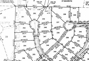
tax map
history cards that were created in 1967. It’s purpose is to maintain
parcel inventory & history
for
county use by identifying all parcels of land within
record,
describing approximately where the property is located, and showing the size of
the property
as
cited on the deed or plat. It is used by the county and many of its
municipalities as a basis for tax
billing,
GIS attribute data, and many other administrative purposes. As with the
original paper cards,
CLaRIS
and the data it contains is NOT a “chain of title” and should not be used for
title or legal purposes.
All
parcel owners shown in CLaRIS are taxable owners as of the tax year and may not
reflect all owners
in the
case of multi-owner parcels. It does not establish or verify ownership
nor does it establish or
verify
size and location. It is a representation of basic information from the
legal documents such as
recorded
deeds and plats as interpreted by county employees.
This includes errors of omission,
commission, concerning the content of the data, and relative
positional accuracy of the data. The
data cannot be construed to be a legal document .
Primary
sources from which this data was
compiled must be consulted for verification of information
represented on this map document.
The records on this site are
unofficial records made available for informational purposes only.
While every effort has been made to
ensure the accuracy of this information, the Register Of Deeds
does not certify the authenticity or
the completeness of any record or of the information presented.
Any person using this website
assumes the risk of any omissions or inaccuracies contained herein.
Register Of Deeds and/or
actions taken or omissions made as a
consequence of any user's reliance upon information contained in
or omitted from this website in any
manner whatsoever. Further,
and all other parties associated
with this website expressly disclaim all warranties with regard to the
accuracy of the information on this
website. Use of this site is an acknowledgement of the disclaimer.
The official records of the Cabarrus
County Register Of Deeds are located at the
Register Of Deeds office.
To begin using the application you must AGREE to the terms and disclaimers provided.
Should you choose not to agree you will be redirected to the Cabarrus County Home Page.
*** To collapse the navigation menu press the “-“ button. To view the navigation menu press the “+” button.
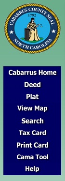
The navigation screen allows the user to quickly jump to other applications to view information related to the Map Card they are viewing. The following describes the links in the navigation window.
Cabarrus Home – TOP Cabarrus County Home Page
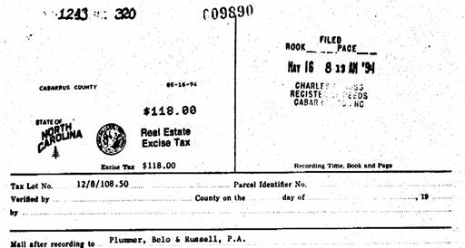
Deed – TOP If no map card has been searched and displayed it will direct the user to the Register of Deeds Document Retrieval page. If a map card has been searched out and the deed book and page is entered and valid then a new screen will open up showing the property deed as shown below.
Plat - TOP If no map card has been searched and displayed it will direct the user to the Register of Deeds Document Retrieval page. If a map card has been searched out and the plat book and page is entered and valid then a new screen will open up showing the property deed as shown below.
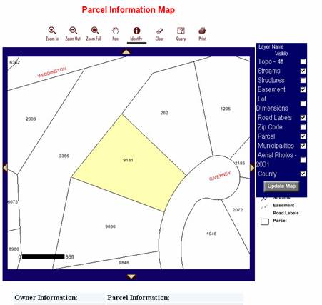
View Map - TOP If no map card has been searched and displayed it will direct the user to the Cabarrus County Parcel lookup site. If a map card has been searched out and the pin number is entered and valid then a new screen will open up showing the property map and associated information.
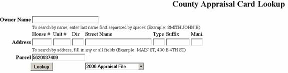
Tax Card - TOP If no map card has been search and displayed it will direct the user to the “County Appraisal Card Lookup”. If a map card has been searched out and the pin number is entered then a new screen will be displayed and populate the Parcel field as shown below. The user then must click the “Lookup” button to display the card.
Print Card - TOP This will display the card and associated information in a format more appropriate for printing. To obtain the best print change your printer settings to LANDSCAPE.
Search - TOP This screen provides many ways to look up the map card for your parcel. You may search by any of the following methods.
· Real ID
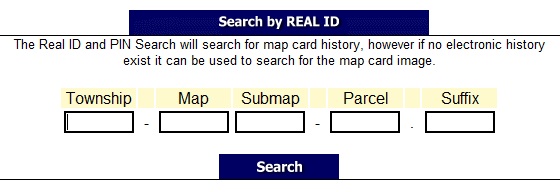
Township, Map & Parcel are required for this search!
· Pin
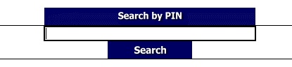
Pin number must be 10 digits in length and numeric!
· Owner Name
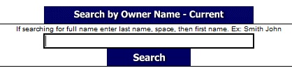
Recommended to search on more than just 1 character.
User may search current and or prior owners.
· Old Pin
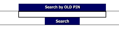
Old pin number must be 10 digits in length and numeric!
· Plat Book & Page
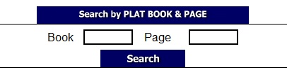
Both fields are required and must be numeric!
· Address
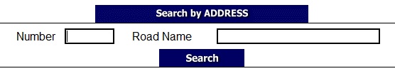
Road name is required for this search.
· Property Description
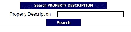
Recommended to search on more than just 1 character.
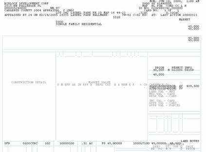
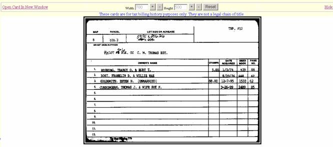
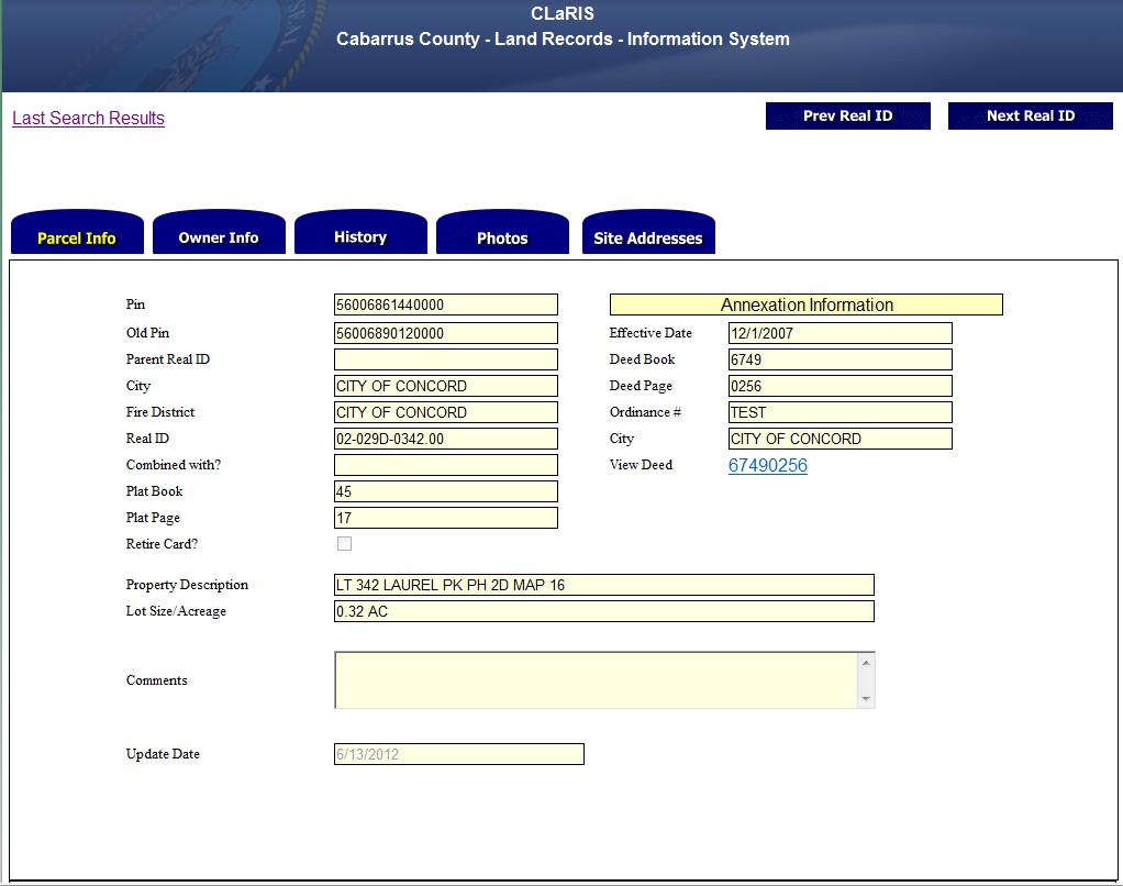
The header record will display the image of the property card and any associated information as shown below. The header record represents the top portion of the map card and the Details section represents the line items on the lower part of the card. Details prior to July 2006 may not be searchable electronically however they will be represented as part of the card image. While viewing the information the user may elect to hide the card by clicking the “Hide Card” link in the upper right hand corner. Also the user may change the height and width of the card by pressing the + or – buttons. The card may be set to its original size by clicking the “RESET” button.
The detail records show data electronically for any transactions that have ocurred after Jan. 2006. The “View Deed” column allows the user to click on the link to view the properties deed. Rows that are hilighted show the current owner, any comments, or additional deeds.
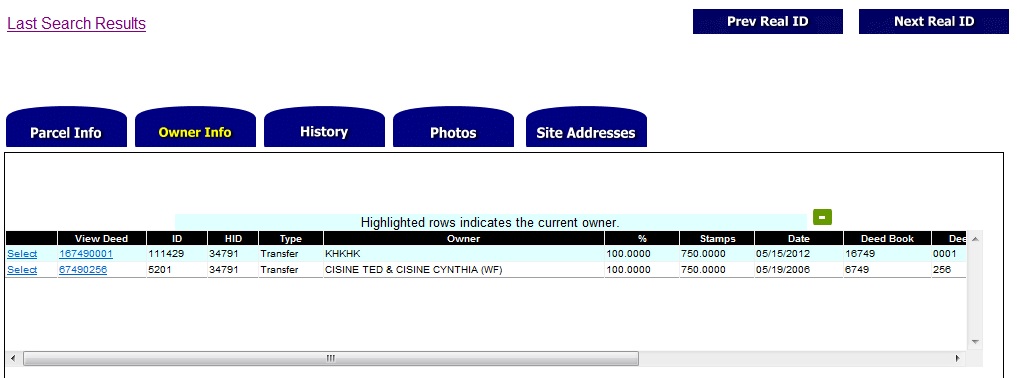
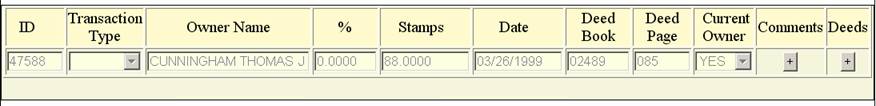
To view the comments or additional deeds (if any exist) click the “Select” link at the beginning of the record. It will display the section as shown below. To view any comments or deeds click the + button.
The history record will provide a listing of all transactions that have occurred on this property electronically vs actually altering the map card.
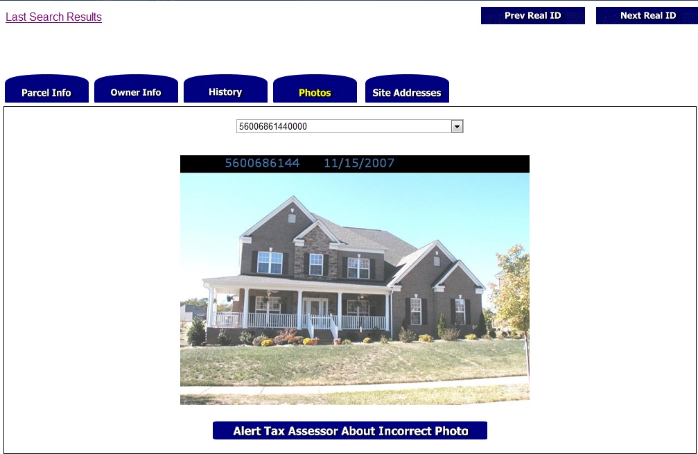
This will display the primary photo of the property as taken from the roadside. If this is not the correct photo for this property you may click the “Alert Tax Assessor About Incorrect Photo” link to notify the Cabarrus County Tax Assessor. You will be required to type in a valid email address and verify it. Then click the submit button. You will receive an email with a link to a form that can be filled out and sent to the tax assessor.
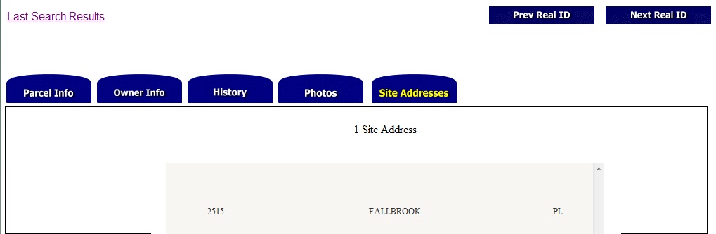
Many times there may be many addresses on one parcel as is the case for apartments and condos. All physical site addresses are displayed as shown below.